By Mary O’KEEFE
Currently Hilary is a hurricane; however, as it moves north into cooler water it should be downgraded to a tropical storm.
“It is going to be a significant storm,” said Jayme Laber, hydrologist from National Oceanic and Atmospheric Administration (NOAA).
NOAA is forecasting two to four inches of rain in the CVW readership area with up to six inches into the mountain areas.
There are flood warnings due to the amount of rainfall expected and the rate that is expected – from 0.5 to 1.5 inches of rain per hour. The peak rainfall is expected early evening Sunday to Monday morning. Flash flooding of urban areas as well as the desert is expected.
“There will be a lot of rain in the Antelope Valley,” Laber said.
Wind will also be an issue with gusts of 30 to 45 miles per hour in the foothills area, with gusts of 50 to 60 miles per hour in the mountains.
Beaches in Southern California will see high surf. In Redondo Beach surf will be five to seven feet on average to a maximum of nine feet. There is also a high rip current risk. Mariners and boaters are advised to find safe harbor due to the dangerous sea conditions.
Catalina Island is one of the areas that is expected to be hit the hardest by high waves and storm surge.
“We will have augmented staffing in place throughout the county starting this weekend. This will include extra engines and firefighters, swift water teams, lifeguards, and heavy equipment,” said Maria Grycan, LA County Fire Dept. spokesperson.
Information shared by Crescenta Valley Town Council:
LA County Public Works weather forecasters and engineers expect possible moderate isolated debris and mudflows for burn areas with less than one year of recovery and smaller isolated mudflows in areas with less than three years of recovery. Public Works debris forecast will be updated on Friday evening. (See the Debris and Mudflow Potential Forecast for communities that may be affected.)
For further information or to report storm-related incidents, contact the Public Works 24/7 Dispatch Center at (800) 675-HELP (4357).
“The majority of [the storm] should pass by [later in the day] on Monday but there will still be a chance of rain and thunderstorms on Tuesday,” he said. “This [storm] is pretty unique for [Southern California].”
It will be categorized as a tropical storm, not a hurricane, but still a significant storm.
Laber said there have been storms categorized as tropical depressions*, but a tropical storm did not hit LA County since 1939 when an unnamed tropical storm went through Long Beach.
A hurricane hit San Diego in 1858 with 75 mph winds; that hurricane was a Category 1.
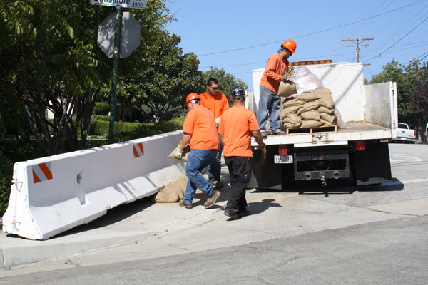
For those who need sandbags visit https://pw.lacounty.gov/dsg/sandbags/ for a list of providers.
The American Red Cross has some advice for preparing for the storm (most of these preparations are similar to preparing for wildfires and earthquakes):
What you should know:
Create an evacuation plan. Plan what to do in case you are separated from family during an emergency and have to evacuate. Make sure to include pets as part of an emergency plan.
Build an emergency kit and include a gallon of water per person per day, non-perishable food, flashlight and first aid kit.
Be informed. Continue to monitor local news and emergency media, including NOAA radio.
Flooding Safety:
Turn around – don’t drown. Stay off the roads.
Follow any evacuation routes and do not try to take shortcuts because they may be blocked.
Stay away from floodwaters.
Keep children and pets away from hazardous sites and floodwaters.
Do not use water that could be contaminated to wash dishes, brush teeth, prepare food, wash hands, make ice or make baby formula.
Do not go near downed power lines.
For more information go to https://tinyurl.com/4n7b8yju.
*According to the National Hurricane Center: A tropical depression is a tropical cyclone with maximum sustained winds of 38 mph or less. A tropical storm is a tropical cyclone with maximum sustained winds of 39 to 74 mph. A hurricane is a tropical cyclone with maximum sustained winds of 74 mph or higher.
